
Table of Contents
The route
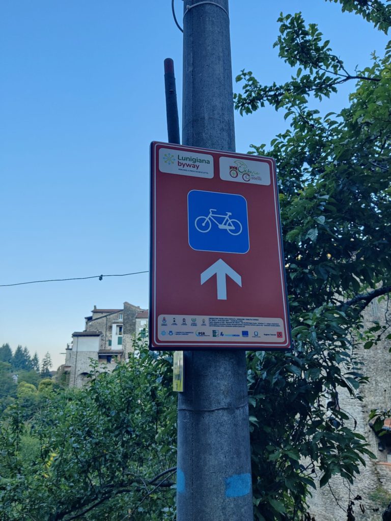
The Lunigiana Cycling Route forms a circular itinerary alongside the Magra river, passing through the towns of Pontremoli, Filattiera, Bagnone, Villafranca, and Mulazzo. It spans a total of 47 kilometers, with 29 kilometers on asphalt, 3 kilometers on pavement, and 15 kilometers on dirt tracks. The route is designated by distinctive brown vertical signs adorned with a white arrow and a bicycle icon, and riders have the flexibility to begin from any point along the path.
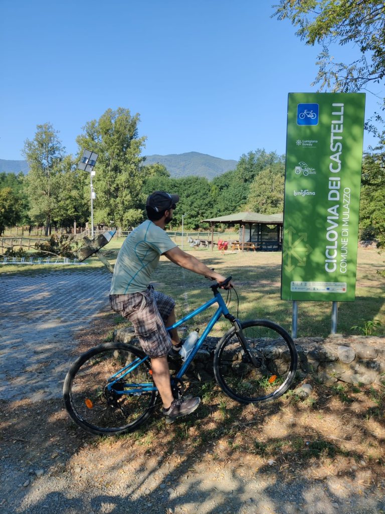
In Italian the route is called “Ciclovia dei Castelli”, which means Cycling Way of the Castles. This of course refers to the many castles that can be found in Lunigiana, with several of them situated along or close to the Cycling Route.
The Ciclovia dei Castelli is a relatively young itinerary, and it is the result of a collaboration between various municipalities in an effort to increase sustainable tourism in the area. In general the route remains in the Magra Valley, with small climbs towards Bagnone and on the west bank of the river Magra, while the rest of the route stays in mostly flat areas. This makes the route a perfect option for families with children, and in general for people who would like to explore the area by bicycle without being trained cyclists.
Interactive map
Signposting
Even though the itinerary is still relatively young, signposting has been placed everywhere along the route making it easy to follow.
You will find several big, vertical signs placed along the route as well as smaller brown signs with bold white arrows indicating the direction of the route.
Most of the time it won’t be necessary to verify the correctness of the route on your mobile device or navigation device, but we still recommend to download the GPX track (see button above) and bring it with you. Sometimes double-checking the route will save you detours and unnecessary climbs back to a missed crossroads.
Drinking water
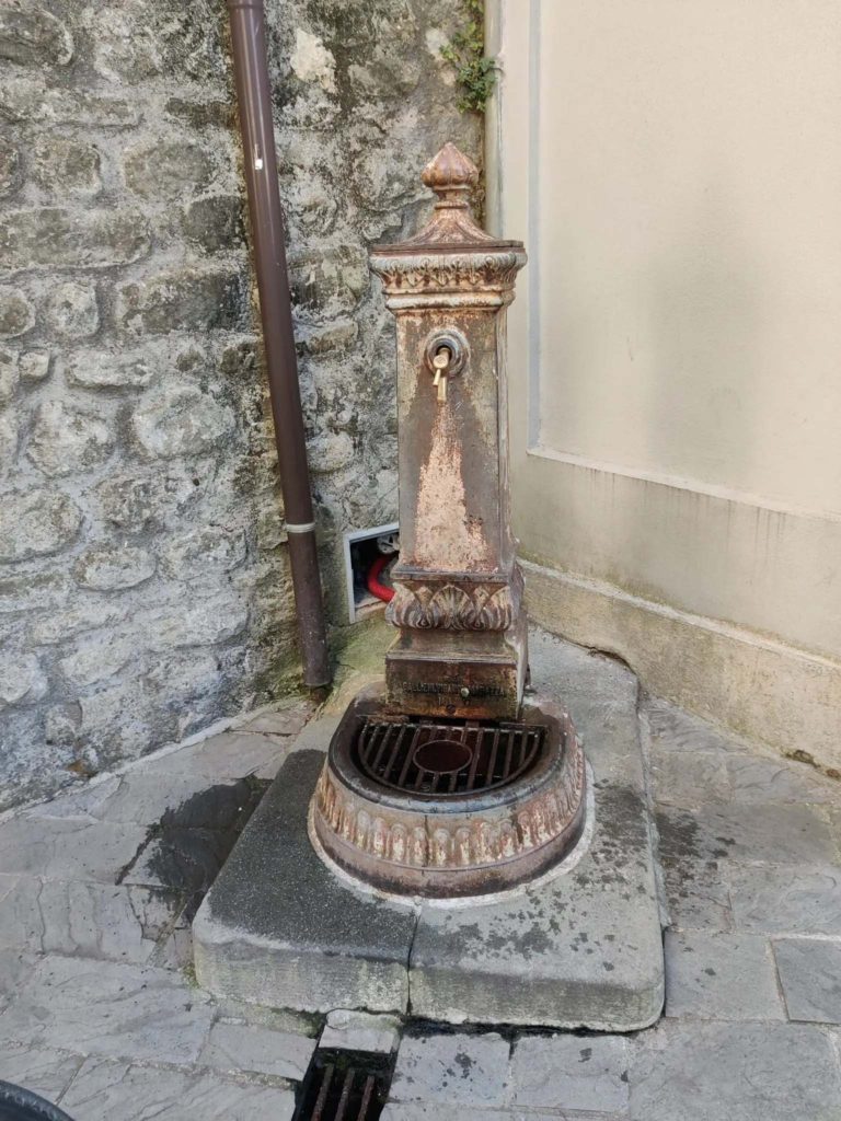
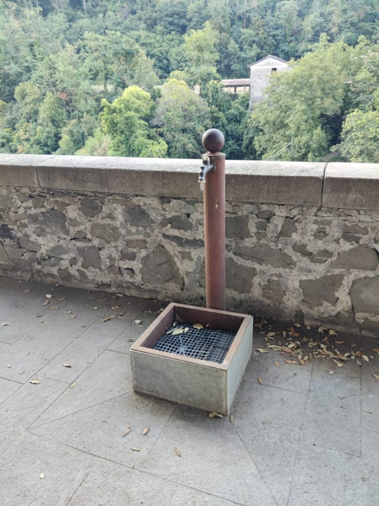
Fortunately for us cyclists, the Lunigiana area does not have a lack of water and therefore also of water fountains offering fresh drinking water. Along the cycling route many water fountains can be found, making it basically impossible for you to run out of water.
You can find the locations of (some of) these water fountains on the interactive map above: they are indicated with a blue marker. Please note that not all water fountains have been added yet; we are currently in the process of mapping the entire route and adding all important waypoints to the map.
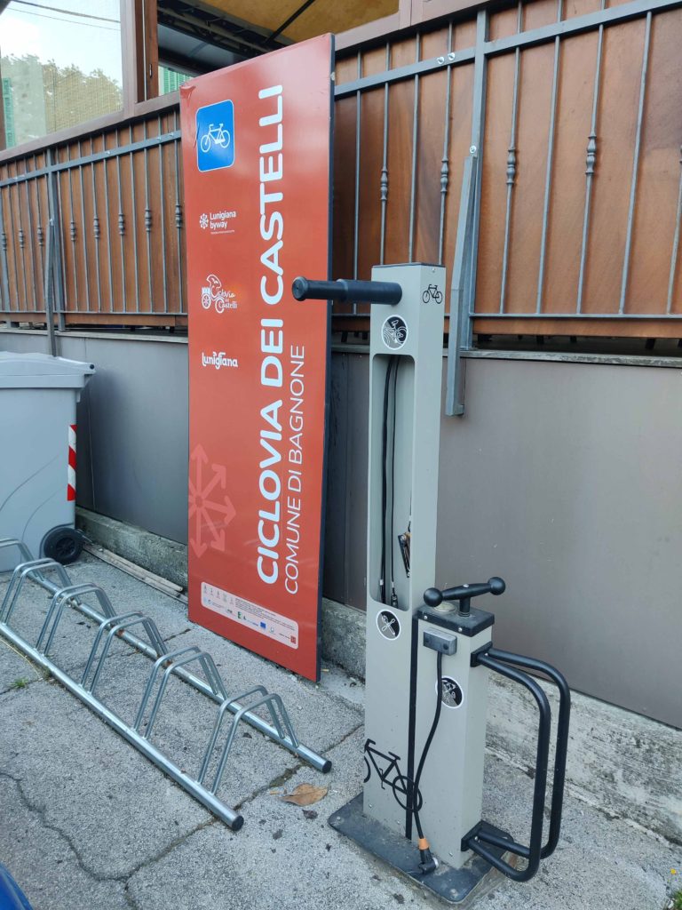
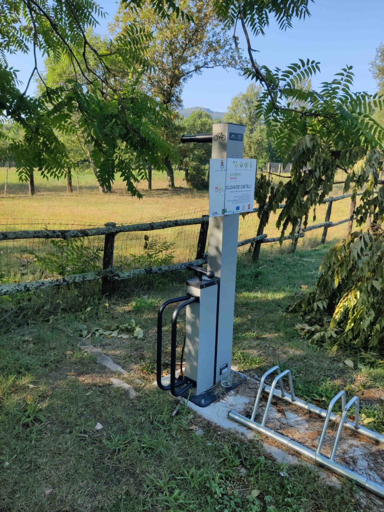
Public bike repair stations
Free public bike repair stations have been positioned along the Lunigiana Cycling Route. This makes it a lot easier for you to fix your bike in case of a flat tire or other unforeseen circumstances.
You can find the locations of these bike repair stations on the interactive map above: they are indicated with a green marker.
Bicycle rent
We recommend that you reach out to the amazing guys at Sigeric. They offer great services and adventurous experiences in the Lunigiana area, and cycling is definitely one of their strong points.
Their bike rental is located next to the “Pieve di Sorano” church, which in front has a parking space available for you. Considering that the Cycling Route is 47 km and therefore doable in one day, this is the perfect place to leave your car in the morning and pick it up again once you’re finished exploring the area on your bicycle.
Starting points
Some locations along the route are better starting points than other, for example because of parking places, which is why we have put together this list of potential starting points for you. These starting points have free parking space available, and most of them also have drinking water nearby:
Pontremoli: Parcheggio Via Chiosi – a big free parking space with a public repair station located next to the Ponte della Crësa bridge. Usually it’s easy to find free parking spots here, but in case of big events such as Medievalis it will be more difficult to find a free space.
Ponticello: Parcheggio di Via Ponticello – it should be quite easy to find free parking space here considering that Ponticello is a very small town.
Filattiera: Parcheggio Pieve di Sorano – this parking place is situated in front of the Pieve di Sorano church and next to the headquarters of Sigeric (bike rental).
Mocrone: Parcheggio Piazza Benedicenti – this parking also features a water fountain. If the parking is full, Mocrone has another parking further ahead (Parcheggio Via S. Maurizio).
Bagnone: Parcheggio Piazza Italia – there’s a parking on both sides of the street here.
Virgoletta: Parcheggio Via delle Fontane – besides a parking space, this area also features benches, a playground, and water fountains.
What to visit along the route
Commencing symbolically at Pontremoli’s historic center near the medieval Cresa bridge, the cycle path embarks along the tree-lined Chiosi avenue. It traverses the Chiosi bridge, passes the enchanting Villa Dosi Delfini, and ascends the Piagnaro hill, crowned by the Castle and its Museum housing Lunigiana’s statue steles. Descending to Piazza del Duomo and Piazza della Repubblica, the vibrant heart of the city, the path continues on cobblestones until exiting through Porta Fiorentina.
The itinerary then weaves along the Via Francigena, briefly meandering through the SS Annunziata village before entering Filattiera and the Caprio Valley. Here, amidst scenic villas, olive groves, and vineyards, the path ascends to Ponticello village, framed by medieval tower houses.
Continuing along the Via Francigena, cyclists follow the Magra River‘s banks, passing the Romanesque Sorano parish church. The route then veers onto an easy gravel road by the riverside. Progressing up the Bagnone Valley through Mocrone and Malgrate, the path culminates at the picturesque Bagnone village and its encircling Castle. The route then transitions to the municipality of Villafranca in Lunigiana, encompassing the medieval hamlet of Virgoletta.
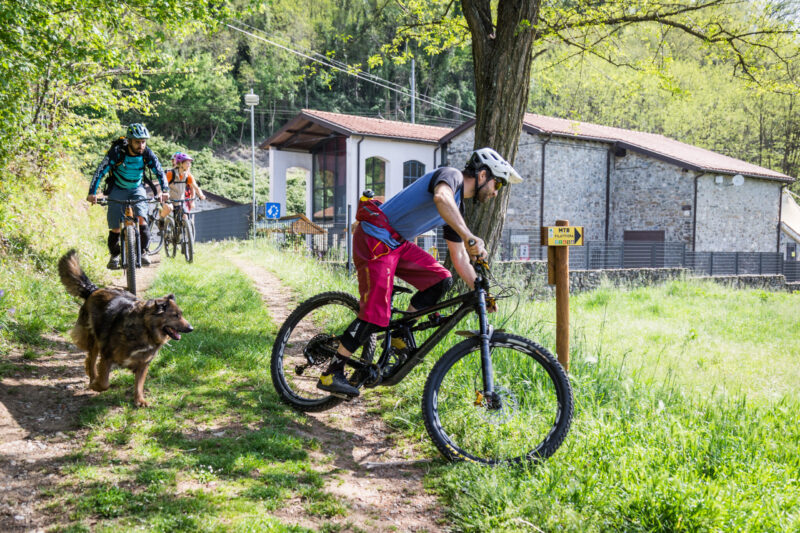
The path proceeds to Villafranca in Lunigiana and its park, adjacent to the Magra River. Crossing the river, cyclists journey through Mulazzo municipality along a nature trail that ascends the right bank valley. Eventually, the route leads back to Pontremoli, offering a diverse and satisfying experience. Throughout the journey, self-repair stations and numerous opportunities for exploration and tastings punctuate the path. Additionally, branching off from the Ciclovia, approximately 20 mountain biking routes of varying difficulty extend into the side valleys, enriching the overall experience.
Eating along the route
Coming soon
Where to sleep
Coming soon